Recently, local naturalists and NHSN’s Earth Sciences Section set out to explore the geology of Holy Island in Northumberland. Take a closer look at what they discovered.
The aim of the trip was to see some of the varied geology of the island, such as the cyclic sediments of the Lower Carboniferous (cyclothems) which include fossiliferous marine limestones. There’s also the most northerly of the Whin Sill suite of doleritic dyke echelons (offset), the Holy Island Dyke.
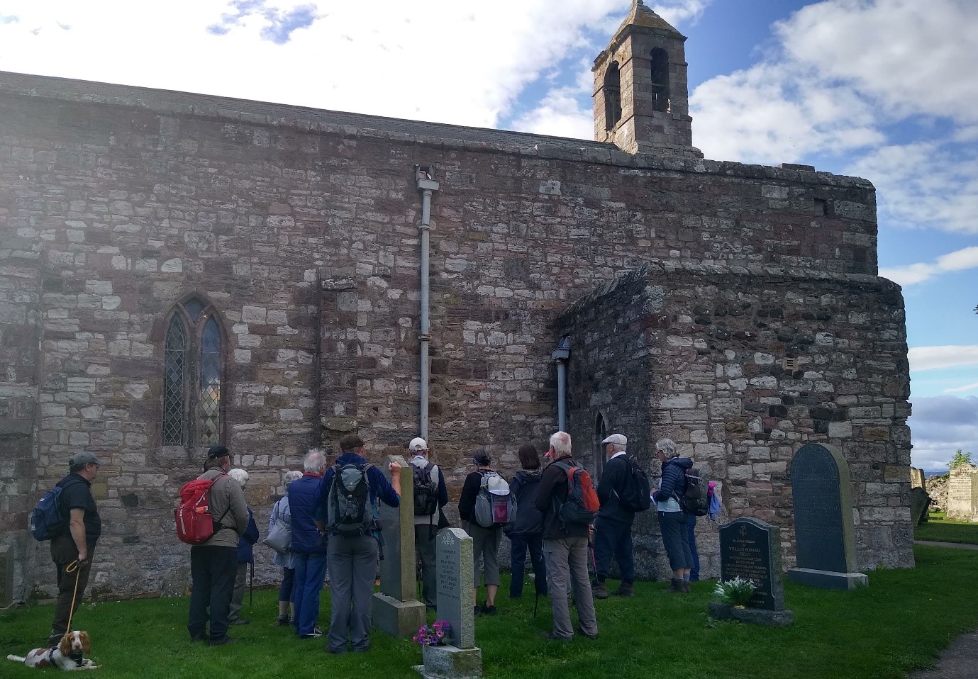
We started the day at St Mary’s parish church (13th century with later additions) next to the famous Priory. The handsome red sandstone ashlar used is reputed to have been brought from mainland shoreline quarries at Cheswick Black Rocks, but could equally have been quarried from the eastern shore line of the island. The purple, reddish and white sandstones were certainly obtained from the Nessend area.
We moved on to the eastern end of Heugh Hill which is an offset segment of the Whinsill dyke that crosses the southern part of the island. A smooth, chilled surface dipping 5° east is exposed at low tide and represents the original upper surface of the dyke. Abundant elongated amygdales and many ‘ropy flow’ structures, all with a southwest trend, could be seen where not seaweed covered.
At Heugh Hill, the contact between the dyke and the Carboniferous country rock is particularly well exposed. About 60 m from the western end, there are three small rafts of saccharoidal limestone in the southern contact zone and a little to the east ‘skins’ of limestone indicate that much of the lower part of the exposure is actual dyke wall.

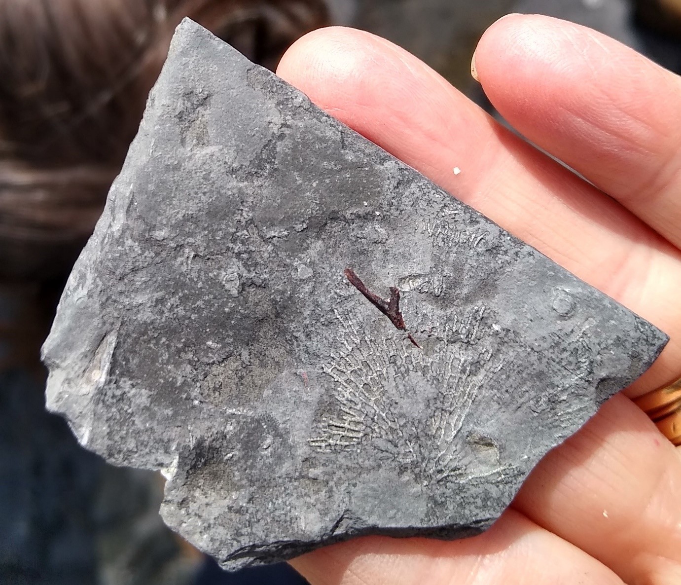
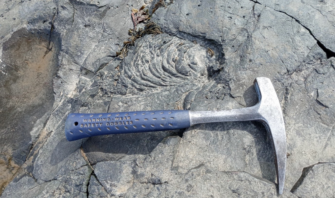
The shales to the east of the Acre Limestone are exposed on the foreshore and quite fossiliferous with many small brachiopods, bryozoan, gastropods and occasional orthoconic nautiloids.

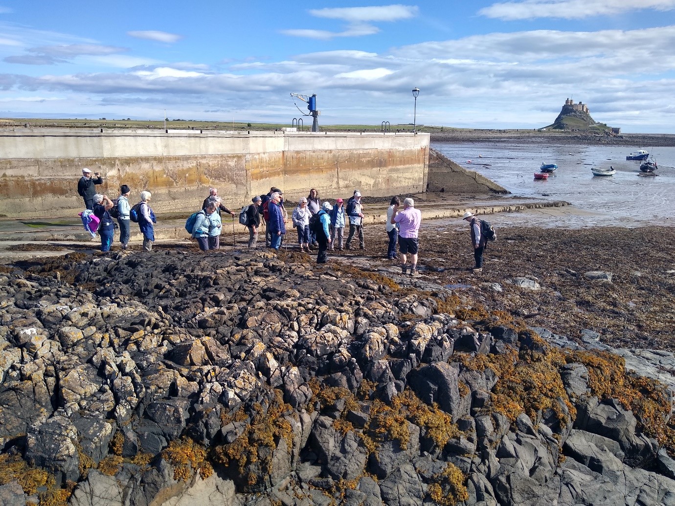
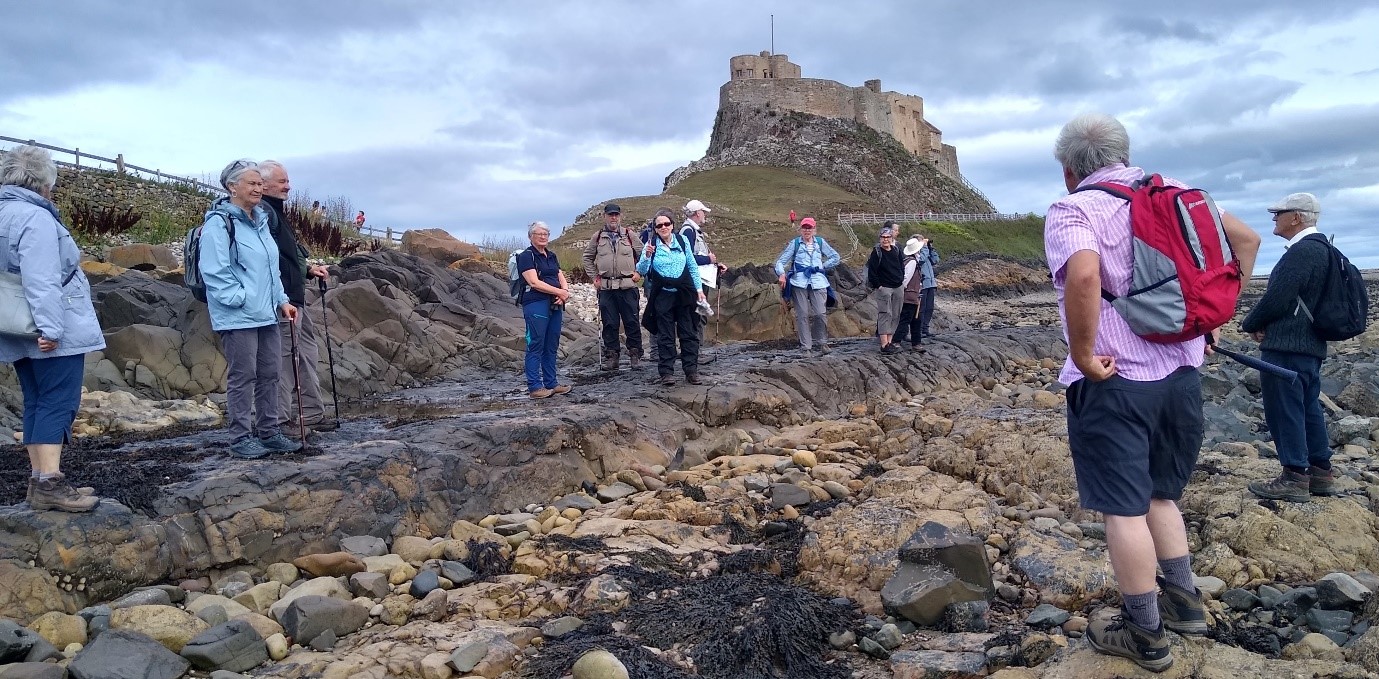
St. Cuthbert’s island is only accessible at low water. The remains of a hermitage used by St Cuthbert around 685 AD are still visible. No vertical contacts are exposed on the eastern margin of this segment of the dyke echelon, but the dominant joints on the island are sub-horizontal. We saw the flat surface formed of chilled rock with its slight easterly dip and which lies mainly below high water mark. The lower amygdale (holes formed by gas bubbles) zone and more ropy flow structures were seen.
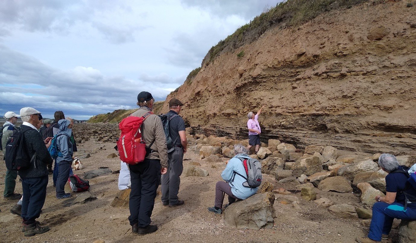
Near Jenny Bell’s Well on the mainland and visible from St Cuthbert’s Island, a 5m high cliff in sandstones and shales overlies the Acre Limestone at the back of the shore. Here, Karl showed us a small fault and low amplitude folds in some of the beds. Interestingly, some beds are much brecciated but lie between unaffected beds. There are also ironstone nodules within the shale. The eastern edge of the cliff is cut by more recent channel deposits, of probable glacial origin, down to shore level.
After lunch, we visited the wooden remains of the lime jetty on the eastern side of The Ouse, the bay between the harbour and Castle. Here we searched for exposures of the Sandbanks Limestone with small brachiopods, intruded by the Riding Stone-Cockle Stone segment of the dyke echelon. At the south side of the eastern end of the segment a 4 m wide flat bench of chilled rock was seen to exhibit more ‘ropy flow’ structures.
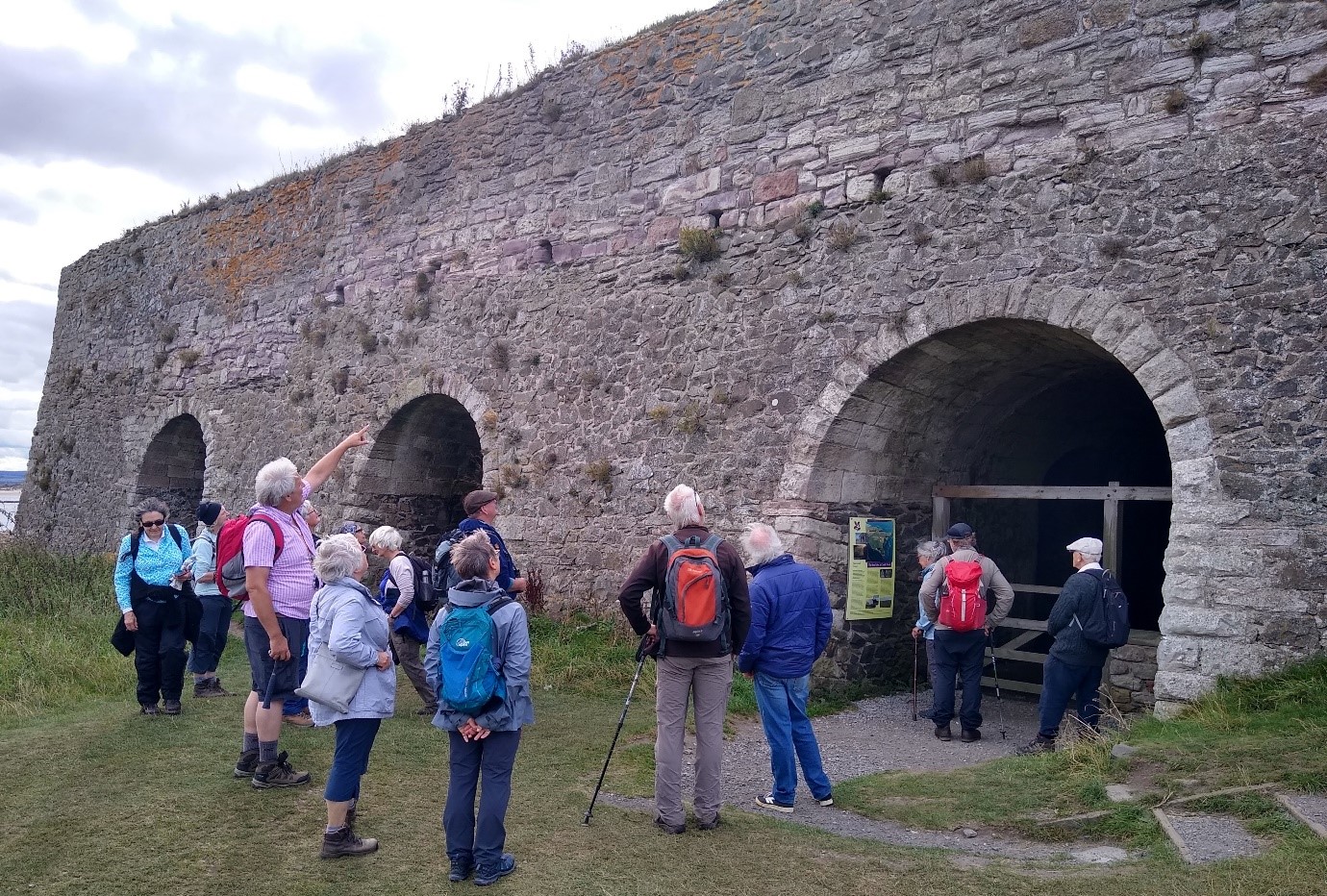
From the high vantage point of Castle Hill on the southeast side of the island, the southward-staggered emplacement of segments of the Holy Island Dyke echelon is clear. At the eastern end of Castle Hill is the large complex of limekilns built in 1860. Large quantities of limestone (for example, 3590 tons for the year ending October 1866), brought from Nessend Quarry via the mineral waggonway (now used as the pathway in the area), were calcined in these kilns. The lime was shipped from the Castle Jetty.
While this was the last of this year’s scheduled trips, there are plans to do one or two more over the next few months, so keep an eye on Newsletters and NHSN adverts. We look forward to welcoming you on one soon!
Content ©Karl Egeland-Eriksen, 2021
Photos ©Brenda Turnbull, 2021