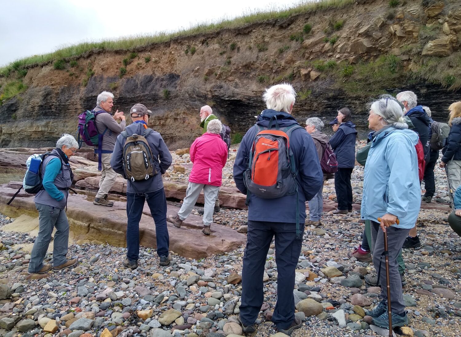
Recently, local naturalists and NHSN’s Earth Sciences Section set out to explore the fascinating geology of Seahouses in Northumberland. Take a closer look at what they discovered.
The day began with a geology and safety briefing. There were golf balls and loose cliff material amongst the hazards to be aware of on this outing besides some fascinating rocks, fossils and geological structures.
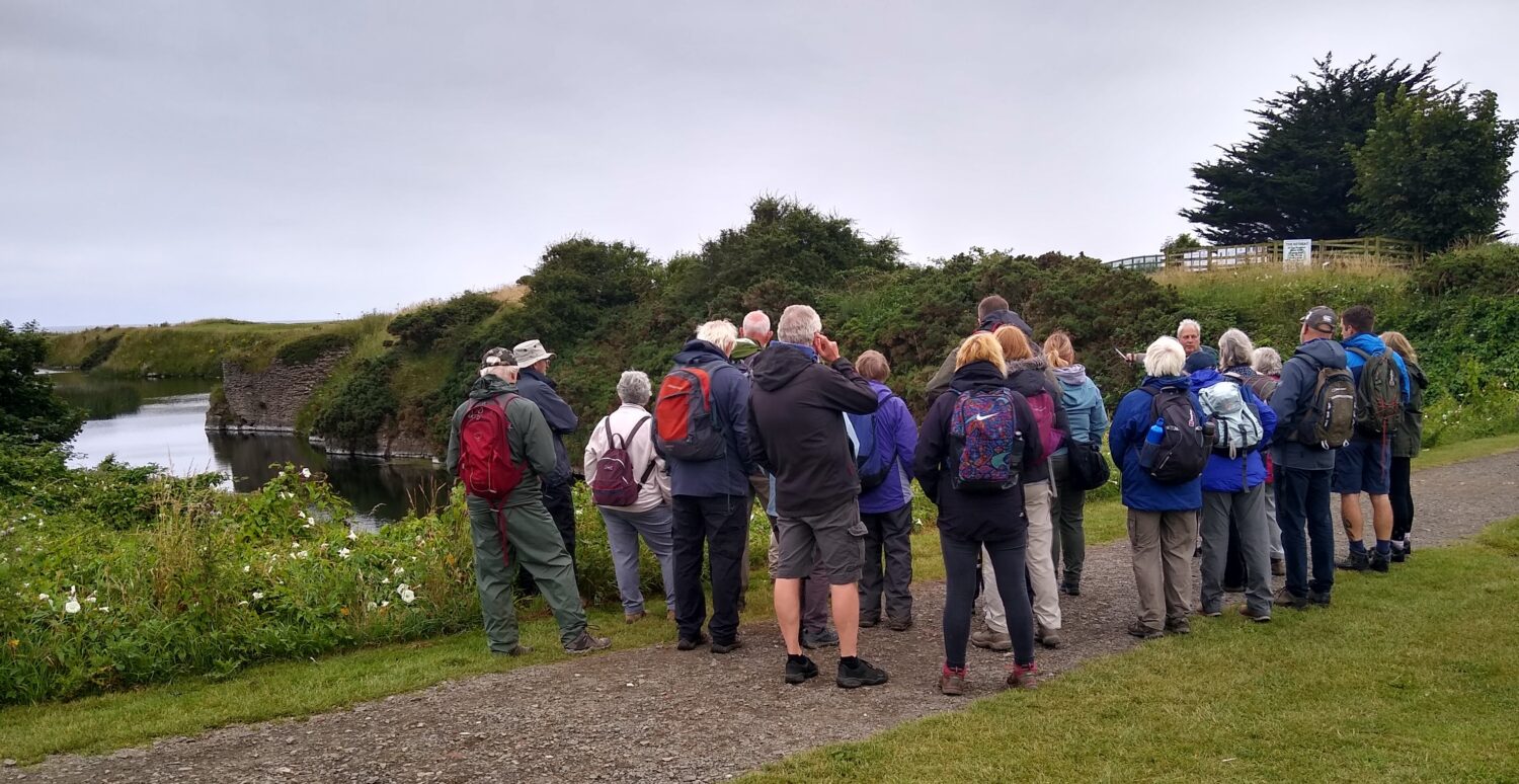
Our walk started by following the path across the golf course and along a ‘lake’. In reality, it is a flooded former quarry in the Eelwell Limestone and was worked to supply the kilns at Seahouses harbour. The quarry ceased to be worked when the Lords of the Manor, the Trustees of the Lord Crewe’s Charities, refused to allow any more coal pits to be sunk around North Sunderland.
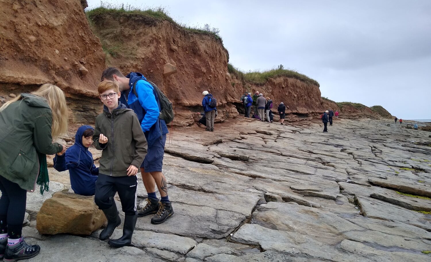
Once on the beach, we headed for the low cliff stretching eastwards to North Sunderland (or Snook Point). The upper portion of the cliff is composed of boulder clay while the lower section is fine shales with the Eelwell Limestone creating the wave-cut platform of the foreshore. The shale is extremely rich in small productid brachiopods and spirifers and also contains some crinoids, trilobites and bryozoans. The limestone dips gently southwards (on the southern limb of an anticline) and is also highly fossiliferous including crinoid fragments, brachiopods, solitary and colonial corals, and gastropods.
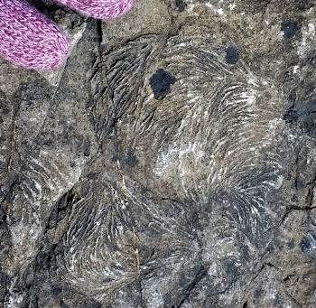
Towards the eastern edge of the outcrop, the surface becomes undulated. The axes of these gentle folds are roughly N-S and probably relates to tectonic activity during the Variscan Orogeny. On some surfaces curious swirling patterns are abundant. These are trace fossils produced by a burrowing worm and are called Zoophycos.
Rounding the point, we descended from the Eelwell Limestone onto underlying finely bedded grey and green sandstones. The shales grade up into them with one particularly contorted band beneath reddish beds containing burrows and rootlets. In the low cliff above these beds is a 20cm thick sandstone unit with a seatearth and thin coal on top; boulder clay overlies the coal. A concrete covered outfall crosses the rocks at this point. Just to the south of it is a 1.5m wide circular hollow in the sandstone. This is not natural but the remains of a former coal pit that worked the coal we have just passed, other examples can be found nearby.
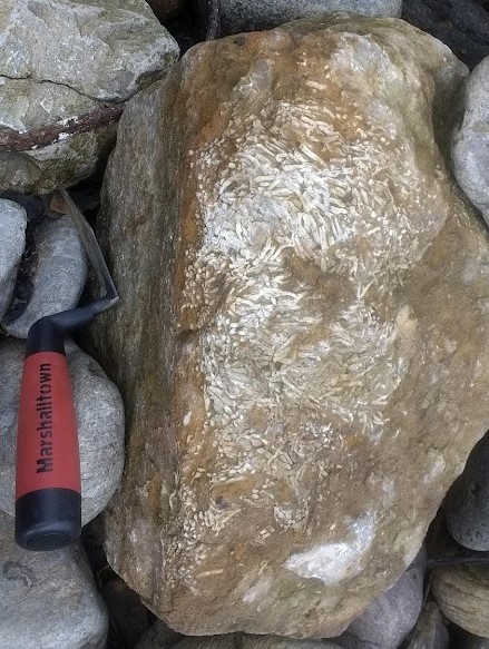
Heading northwards, we found a thin limestone, many boulders of which can be seen on the beach with a band of colonial coral towards the top (Lithostrotion?) On the upper surface there were more examples of the trace fossil Zoophycos and immediately overlying this is a highly fossiliferous, calcareous shale, rich in Productids and Spirifers. Above the fossiliferous layer are several thin, ironstone rich bands.
The last stop of the morning was a thick bed of grey shale containing interesting sand structures. Careful examination revealed Stigmaria indicating the sandy structures are related to tree roots and the grey shales are actually a seatearth or fossil soil. Above the seatearth a thin coal is present, the North Sunderland Coal or Beadnell Coal, reported to be up to a metre thick in places which was worked to fuel the lime kilns at the harbour.
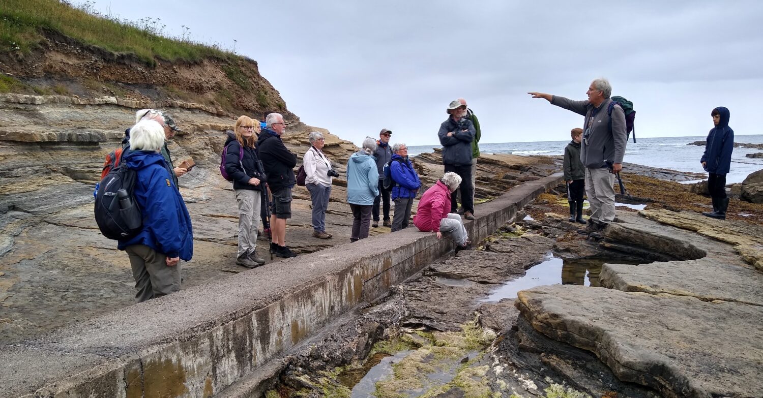
After lunch, we headed towards Braidcarr Rocks. Looking back at the cliff, we saw that the beds were near horizontal and this is because this locality is near the axis of the anticline. The wave-cut platform beneath the cliff is a hard shale with many ironstone nodules and plant fragments. The shale continues at the base of the cliff and is topped by a thin coal. An undulating erosion surface marks the contact with the overlying sandstone. More shale follows with a thick sandstone above.
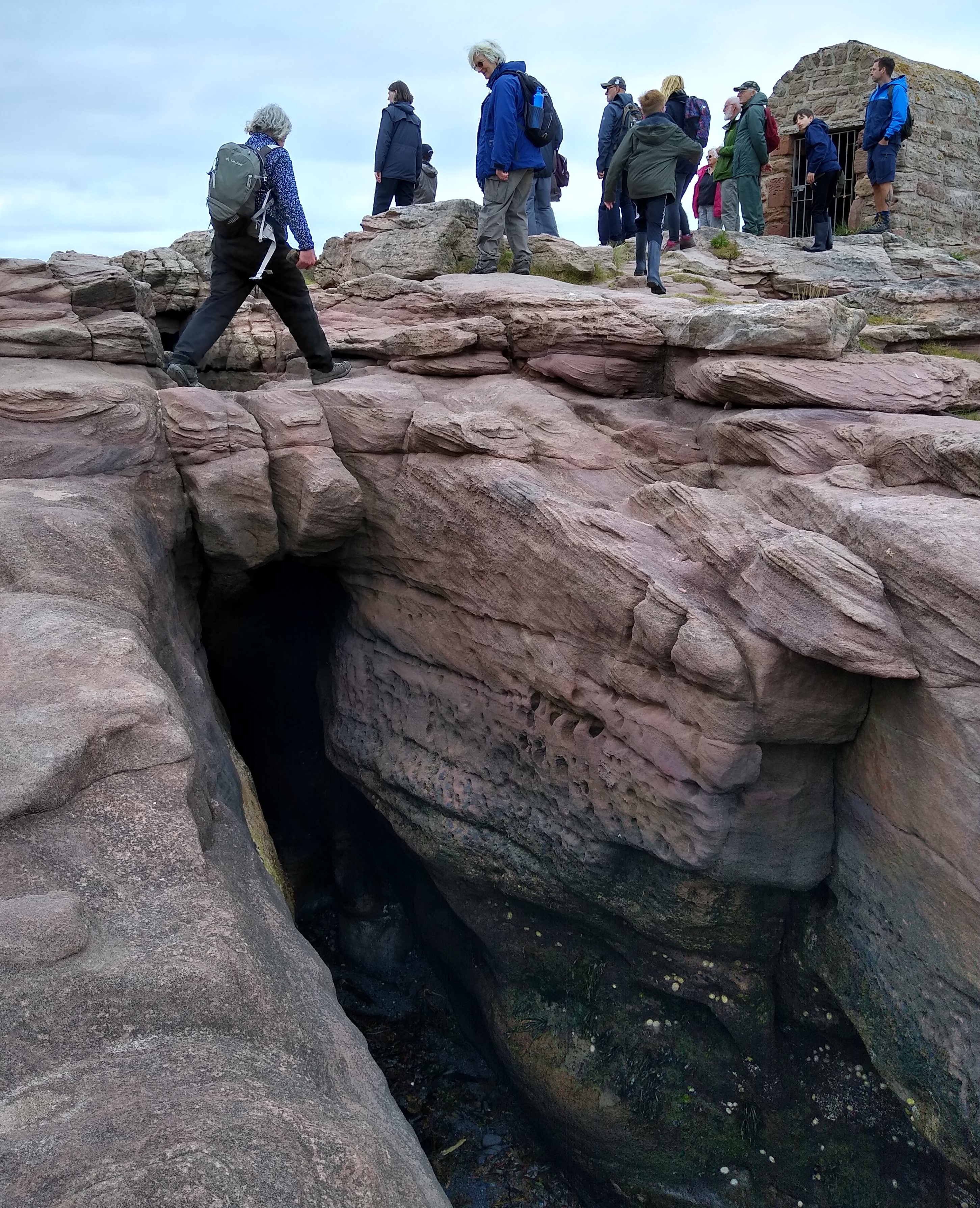
At our last stop, we headed seaward towards the breakwater at Southrock End. The sandstones here are heavily cross-stratified and reddened. A stone hut close to the breakwater on Pace Hill is the Powder House, built in 1886 to house gunpowder used in blasting for the construction of the New Harbour and Long Pier.
The next trip is Sunday 22nd August when we’ll visit Ingram Valley in the Cheviots. All are welcome and knowledge of geology is not necessary. Notes, similar in pitch to this write up, will be available beforehand to assist understanding of what will be seen during the outing.
Content © Karl Egeland-Eriksen, 2021.
Photos © Brenda Turnbull, 2021