Recently, local naturalists and NHSN’s Earth Sciences Specialist Group set out to explore the geology of the Seaham Coast. Take a look at what they discovered.
Red Acre Point
Seaham harbour comprises two docks. The North Dock, built in the first quarter of the 19th century, and the larger South Dock, extended in 1899. Many limestone outcrops were demolished to construct the North Dock for Lord Londonderry with work beginning in 1828. Faulting in the region around Seaham has downthrown rocks about 200m to the north of the Seaham Fault and the East-West fault runs through the centre of South Dock. As a result, it has exposed the highest strata found within the Magnesian Limestone in the north-east.
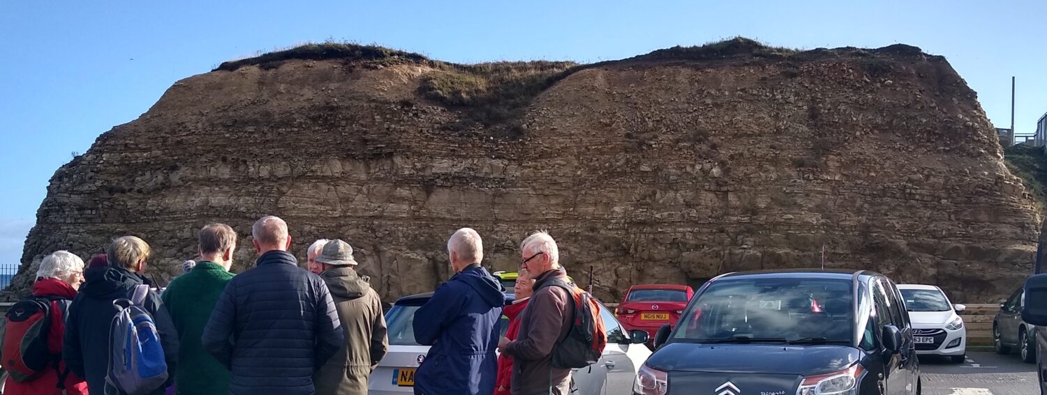
Seaham Formation at Red Acre Point
The rocks at Red Acre Point and in the cliffs behind the beach to the north are the type locality for the Seaham Formation (EZ3) and about 31m of the formation is exposed here. Much of the limestone is fine-grained and thinly bedded. Some are rich in fossils such as the bivalves Liebea and Schizodus. Several beds are packed with the alga Calcinema, occasionally showing current orientation. Post-depositional changes have produced thick beds with spectacular calcite concretions like those found in the EZ2, Concretionary Limestone.
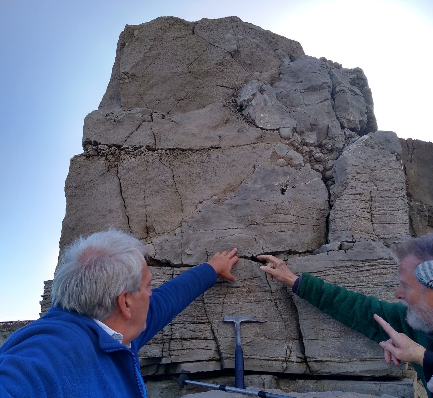
Fossils and Concretions
Seaham Foreshore
The cliff face 150m north of Seaham harbour is one of the best examples of an evaporite dissolution residue in Britain. The Seaham Residue, the dissolution residue of the EZ2 Cycle (Fordon) evaporites is thickest here – up to 9m. Beneath the spoil and boulder clay at the top of the cliff is around 8m of slightly dislocated limestone of the Seaham Formation.
It is mainly fine-grained, buff to grey and highly fossiliferous in some beds. Beneath are the insoluble remains of the Fordon Evaporite Formation. The lower and upper units are of heterogeneous calcareous clay or clayey limestone separated by a median unit (2m) of dislocated white to buff oolitic limestone.
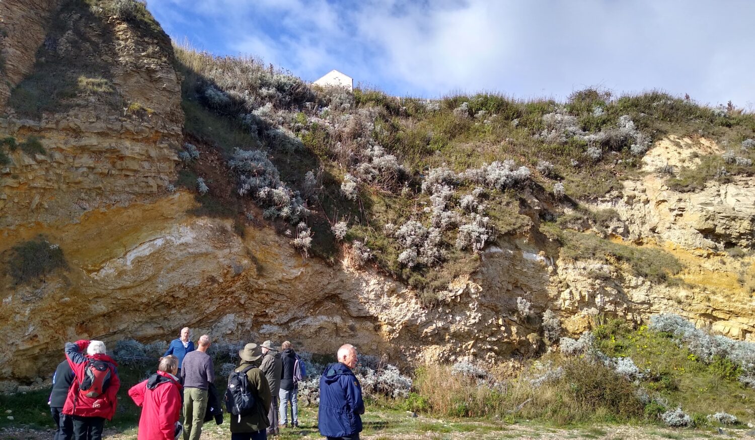
Contorted Seaham Residue Overlain by Bedded Seaham Formation
The Roker Dolomite Formation (EZ2) is displayed at low tide in the rock platform known as Featherbed Rocks. Here the rock contains complex veins of calcite and sheets of dedolomitised limestone.
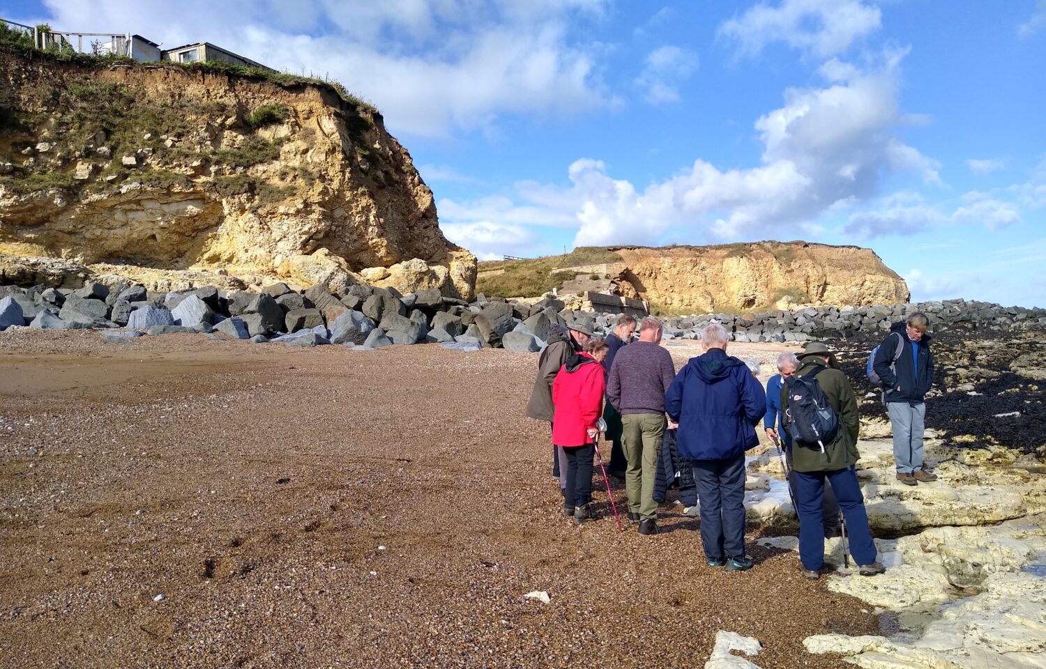
Featherbed Rocks in the Foreground, Larvikite and Whin Sill at the Base of the Cliff
Protecting the cliffs from further erosion are large blocks of larvikite, some containing extremely large crystals. Smaller blocks of dolerite (Whin Sill) can also be found including pegmatitic forms. Both are Permian in age.
Blast Beach
Nose’s Point was the site of numerous industries in the 18th and 19th centuries. These included a bottleworks factory in 1855, an ironworks in 1862 and a chemical works in 1865. It finally became the location of Dawdon Colliery, opened in 1907, which at one point broke national and European production records and was one of the last pits to close in the region in 1991.
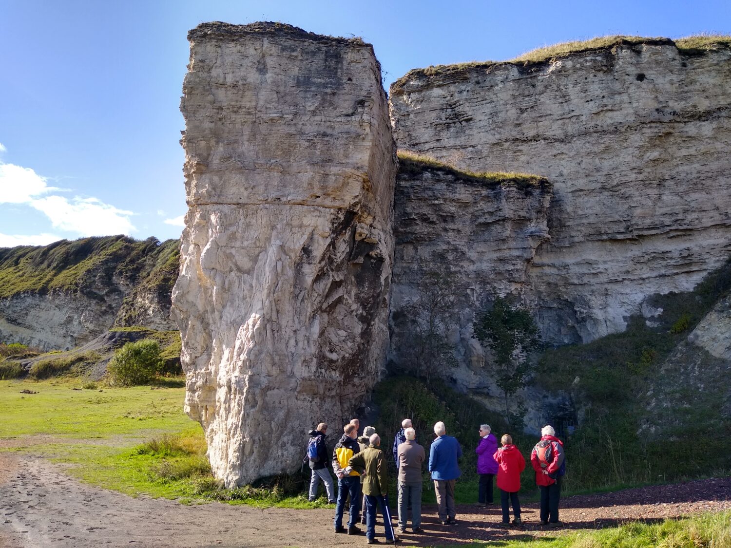
Mine Entrance in Roker Formation Below Nose’s Point
Colliery waste was dumped onto the Blast Beach, below the site resulting in environmental devastation. The barren landscape was even used in the opening sequences of Alien 3. Blast Beach is named after the blast furnaces of the former ironworks at the site.
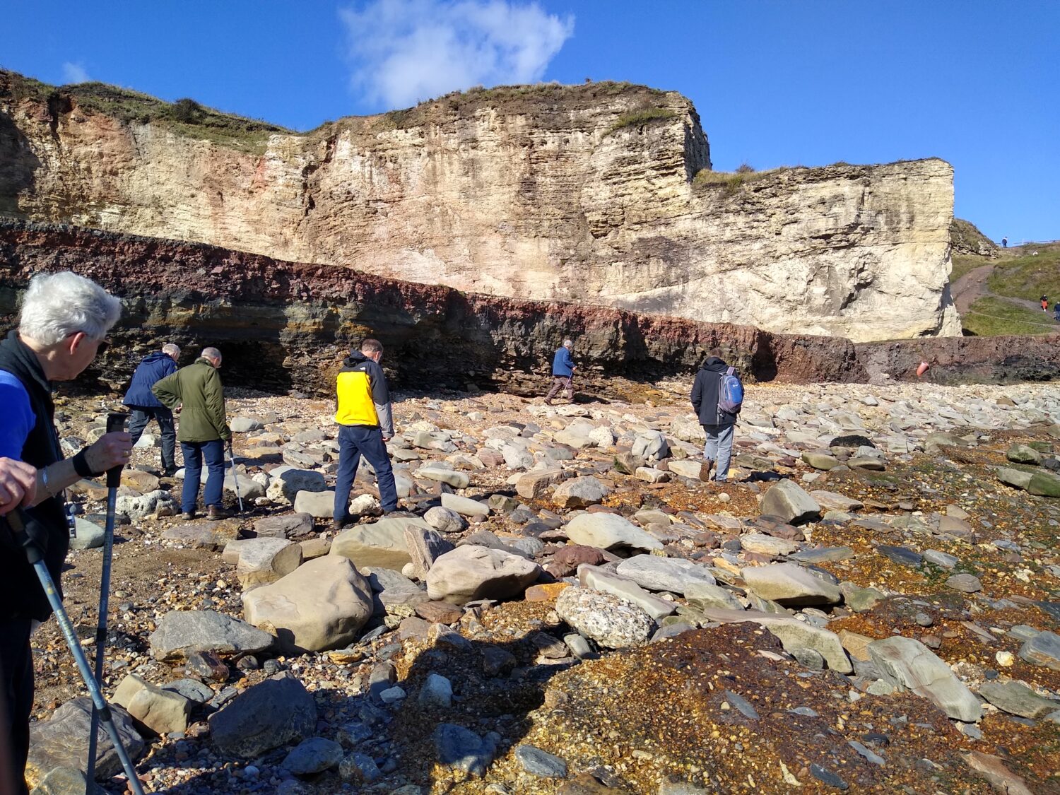
The Shelf of Industrial Waste on Blast Beach
This was the last trip of the year and we’d like to thank everyone who has come along and been so enthusiastic about our local geology. It’s been great to meet you and a pleasure to show you some of the north east’s very special geological sites.
We hope to return to field trips in Spring 2023.
In the meantime,
- Look out for geology courses run by Karl for the NHSN
- Join us and others on trips with Northumbria Branch of the Open University Geological Society (NOUGS)
- North East Geological Society (NEGS) trips and winter lecture series
Text & photos – Karl Egeland -Eriksen & Brenda Turnbull, Earth Science Coordinators